DAILY ESCAPES
Home » THINGS TO DO » DAILY ESCAPES » Elassona – Polyfytos Lake – Velventos
130 km from Litochoro
69 km from Elassona
Car Route
All Seasons
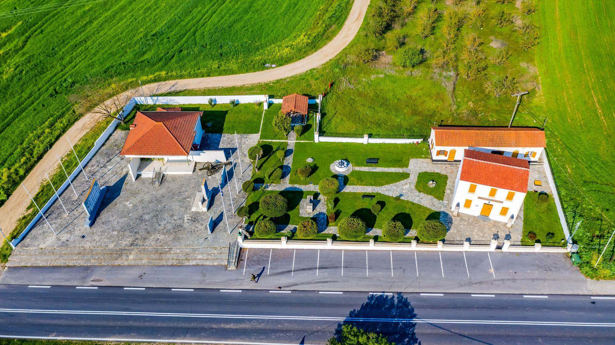
Seventy kilometers overflown with intense, alternating nature separate Elassona from Velventos (in the region of Kozani). History is in equal abundance and begins to unfold as soon as you reach the 20th km of the Elassona-Kozani road. This is where Hatzigogou’s Chani is located. The building was used by the troops of the Greek successor to the throne, Constantine, as headquarters in the Battle of Sarantaporos. It is here that on October 1912 the Greek armed forces defeated the Turks. This was a decisive victory as it led, a while later, to the liberation of Western and Central Macedonia. Nearby, a museum exhibits material evidence surviving from the battle (armature, military uniforms, etc.) and a memorial monument has been raised to commemorate those who died in the war.
Shortly after Sarantaporos, in the wider region of Microvaltos and Livaderos, you come across one of Greece’s most unique landscapes. The “Boucharia”, in Microvaltos, are curious geological formations weirdly shaped as columns. Varying in height, reaching from 2 to 6 meters, these columns have been formed after erosions thousands of years ago. The peaks of the columns, which are covered with horizontal plates, create an otherworldly “alien” spectacle. The geological “curiosity” met in Boucharia doesn’t end there. Close by, in Livadero, a series of conical formations, two-kilometers long, called “Nochtaria” form an amazing geo-park that makes a lasting impression to visitors.
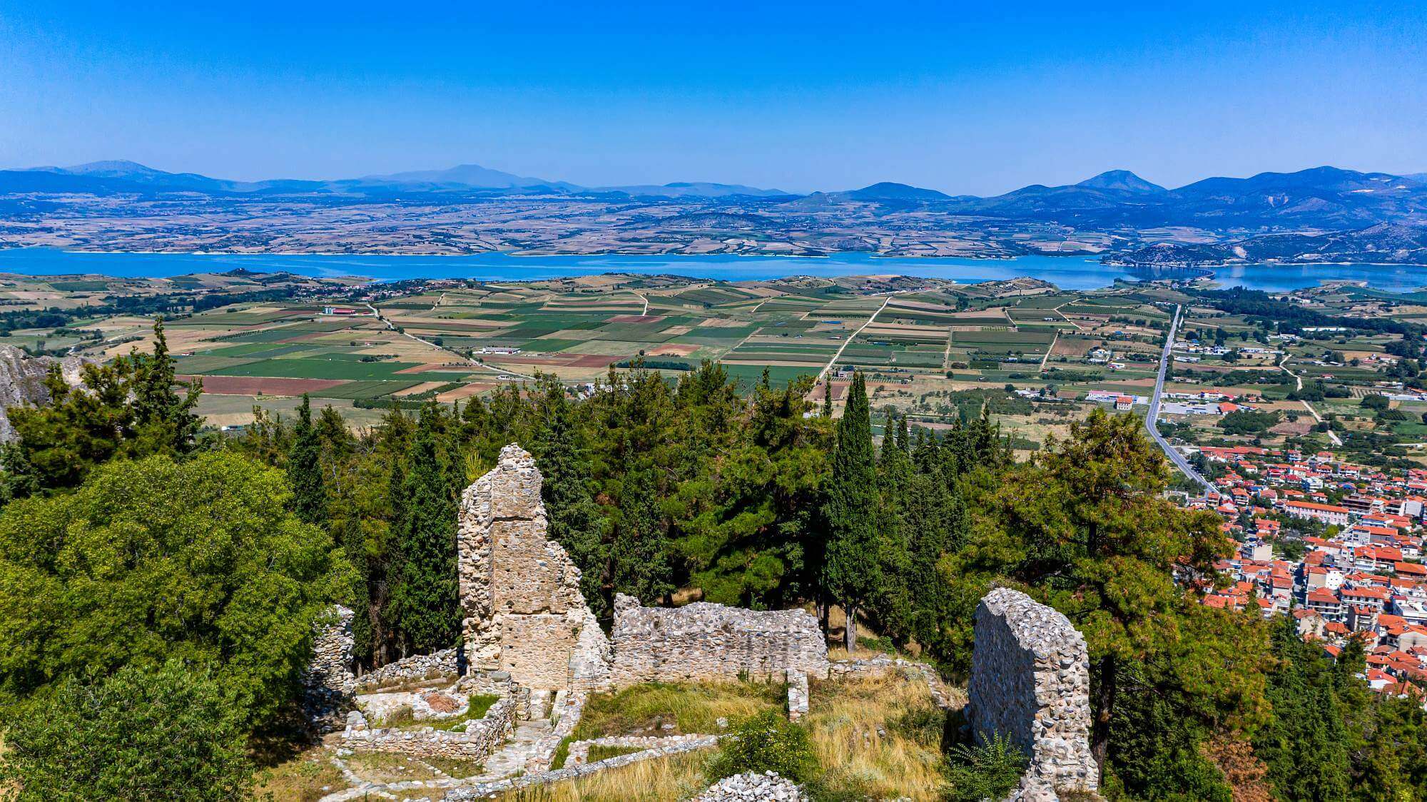
Next stop is a “doorway” in time. The almost unknown Byzantine castle-city of Servia Kozanis emerges with its Acropolis offering stunning views to the area. Old Byzantine churches, like the 11th-century episcopal Church of Agioi Theodoroi, the Church of Agios Prodromos and the Church of Agios Georgios bring to light the region’s long-standing religious tradition with their magnificent Byzantine decorations and murals. Another striking feature of the region is the Canyon of Servia. Nearly three-kilometers long, it is breathtaking with its human and animal-like geological formations and its point of entry by the Chapel of Agioi Anargyroi.
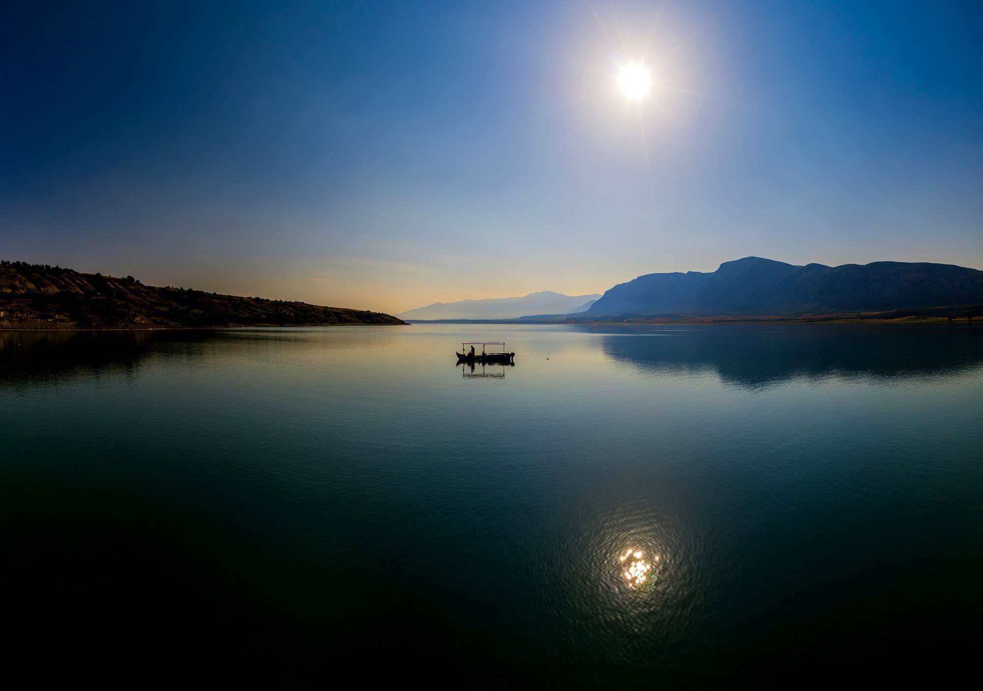
In the highlands of Kozani, there is Polyfytos Lake, the largest man-made lake in Greece. It was created after the construction of the local dam, which was flooded by the vibrant waters of Aliakmonas River. An ecosystem of unimaginable beauty and home to over 120 species of birds, 17 species of fish, woodland with plane and willow trees, the lake is a popular spot for bird-watching, fishing, rowing, water-skiing and sunset walks. Making a stop at the dam just to take photos is a must-do. The lake is also crossed by the longest bridge in the country, the High Bridge of Servia, wherein nature and technology seem to bond in perfect harmony. Crossing this amazing 1,372m long bridge is certainly an outstanding experience. Over on the other side, there is the village of Neraida. Built high up on the hill, the village is an ideal place to stop for either having something to eat or for taking pictures of the lake.
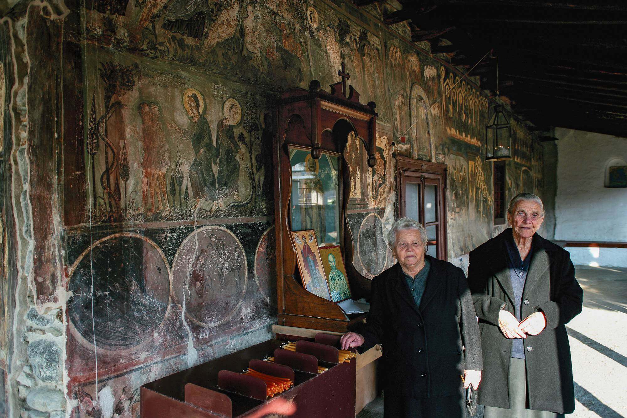
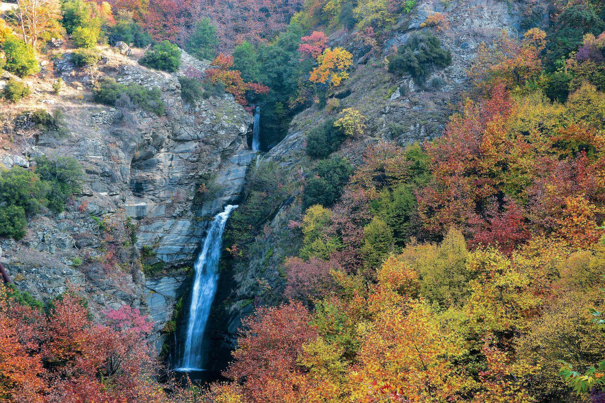
If there is time available, it is worth visiting Velvento, which is located 15km away from Servia. In this picturesque town you will admire Macedonian architecture and visit the Byzantine churches of Agios Minas, Agios Nikolaos and Agios Dimitrios Gratsianis. You shouldn’t miss trying the famous peaches of Velvento and visiting one of the region’s wineries. Approximately 2.5km from Velvento, nature is doing again its miracle. The canyon and waterfalls of Skepasmeno, with the steep rocks on the one side and the lush environment on the other, with the natural ponds and waterfalls, establish a scenery made in heaven. Canoe-Kayak and rappelling are some of the activities that you may enjoy if you wish to have a lifetime experience in the canyon.
The inn of Chatzigogos. In 1912, during the battle of Sarantaporo, it was the commanding office of the Greek army; today it is used as a museum. The Greek army began the war against the Turks in Elassona. In October 1912, armies of the four Balkan allied countries simultaneously invaded Europe. The Greek army freed Deskati and reached the straits of Sarantaporo. The Turks gathered together all their forces. A frontal attack took place in the Sarantaporo area and on 3 October, after being surrounded, the Turks abandoned their arms and ammunition and fled. The Greek army in Sarantaporo wrote the first epopee of the victorious war of 1912-1913.
“Boucharia” in Mikrovalto. Many myths have attempted to interpret this impressive phenomenon. These are actually natural geoforms that have been created by soil erosion in a period of thousands of years. Their name comes from the word “bouchari” which in the local dialect means chimney.
At the highest point of Servia, stands the impressive mass of one of the most important castles of the mid-Byzantine and late-Byzantine period in Western Macedonia. The castle of Servia is located between Pieria and Kamvounia mountains, in an impressive, rocky terrain filled with gorges.
Legend has it that the gorge of Velvento was inhabited by the Lafisties priestesses of Dionysos. Here the Pierides Muses used to come in order to wash in the river and dance. The gorge springs from Lake Polyfytos of Aliakmonas river and reaches the village of Katafygi. Along its course, which crosses the Lafista stream – falls and small picturesque lakes give a special colour to the landscape. In the 1950s, the people of Velvento constructed a big covered canal in order to carry the water of Lafista to the plain, and this canal gave its name to the region which was called “Skepasmeno” (covered).
